
For navigation and for recording tracks and speeds, airlogOne uses the GPS system, today mostly in the form of the GNSS (Global Navigation Satellite System), which uses the various satellite navigation systems in parallel.
Why are there situations in which the direction arrow does not seem to indicate correctly?
This is due to the GPS technology: by definition, all GNS systems only record positions, or more precisely: points in space – without any movement, direction or speed.
Only the sequence of these position points allows the calculation of direction and speed.
The orientation of the receiver (i.e. the antenna or GPS chip) plays no role in the detection of the position point, which is always the same, regardless of whether the device is lying down, standing or hanging upside down.
So if a GPS receiver is worn somewhere on the jumper’s arm and he is in the airplane with his back to the pilot, the position point sequence moves further and further away from the take-off site. However, the airlogOne arrow supposedly does not point back to the field but in the direction of flight.
Why: The problem is the sitting position against the direction of movement (back to the pilot) and the view of the device in front of the chest: The airlogOne is also mounted 180 degrees against the direction of movement and the arrow points away from the DZ – so it’s wrong!
It only becomes correct again when we turn the device in the direction of flight, i.e. the display can be read in the direction of flight, then the arrow is also correct.
This must of course also be taken into account when under canopy – a glance to the left at the arm will show an arrow in the wrong direction if you do not transpose correctly in your head.
So always: To read the direction: Place the device in front of your chest in the direction of flight. Or attach it to the chest strap. With the mudflap, make sure that you always have to turn in your head when attaching it at 90 degrees.
Here is some background
GPS essentially records position data and the exact time, so initially no direction and no speed (here, as always, everything is simplified), but direction and speed information can be derived from a sequence of position points with a time stamp.
Two points in succession, projected onto the surface of the earth, give me an angle in relation to north (= direction, heading, course) and a distance – together a motion vector. The projection onto the earth’s surface is important, because in our case the earth is not a disk, but rather a slightly egg-shaped sphere, an ellipsoid, which is also defined differently in different countries.
For the short distances that we fly on the canopy, this does not make much difference (the short curvature segments do not differ much from a straight line).
However, if I want to travel to another continent, I should make sure to use correct calculations.
If I measure the time between two position points and calculate the distance traveled, I can determine the exact speed of my movement.
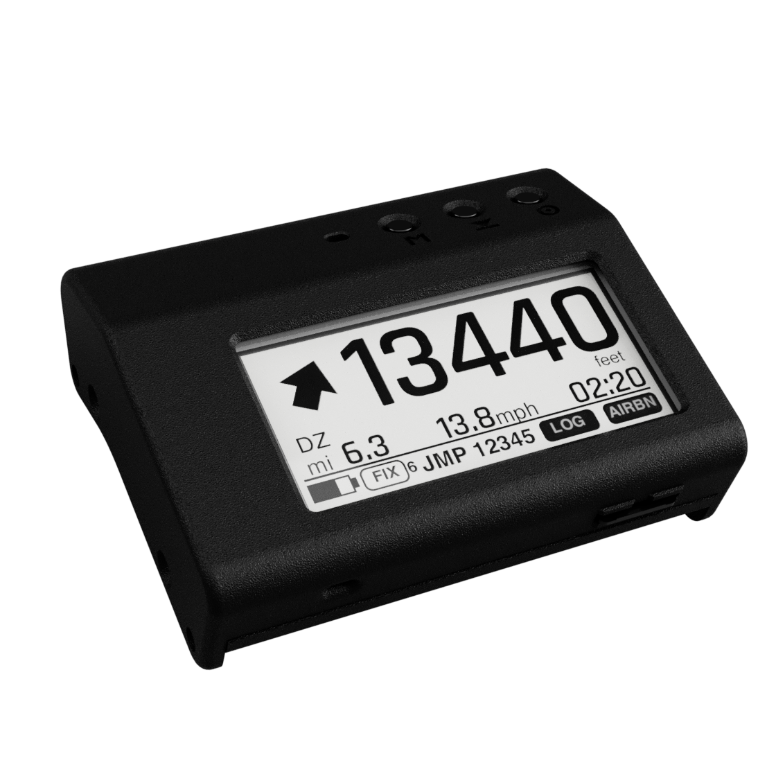
With the GPS data position, direction and speed airlogOne shows the correct flight direction to the target point, usually the home drop zone. Together with the altitude, this is important information that makes flight planning and landing approaches safer.